
Share this Source:
Slave Population of the Southern States in 1860
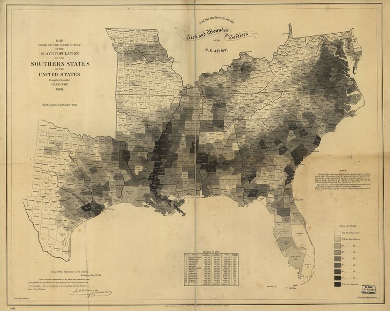
1861 Antebellum (1820-1861)A map showing the distribution of the slave population of the southern states, compiled from the census of 1860.
Source
Publisher
Rights
Public Domain
Format
JPEG
Item Type
Cartographic
Original Format
Map
Physical Dimensions
69 x 86 cm
Geography and Map Division, Library of Congress, Washington, DC.
http://hdl.loc.gov/loc.gmd/g3861e.cw0013200